1cm GPS accuracy? Not really on a boat but...

LittleSister

Well-known member
Joined
12 Nov 2007
Messages
17,760
Location
Me Norfolk/Suffolk border - Boat Deben & Southwold
Visit site
Can't you go into the display settings and dampened down the refresh rate to 15 seconds or such. I did that that with my elderly furuno 31 as otherwise it was a waste of time.

Not as far as I could ever work out. There is simply a fast/slow toggle, but it doesn't make anywhere near enough difference.

If anyone knows how you can change it significantly, I'd love to know. I can live with it, but it's annoying, and is presumably consuming unnecessary power, doing calculations every couple of seconds.
 

johnalison

Well-known member
Joined
14 Feb 2007
Messages
39,202
Location
Essex
Visit site
I remember us being utterly amazed when a friend got an early boat GPS (and that was with selective availability, or whatever). We'd been used to having only an approximate idea of where we were once we were out of sight of land. Now this thing claimed to tell us where we were within something like 20m(?)! We'd previously approached a coast cautiously, peering anxiously ahead looking for lighthouses, prominent buildings and cliffs etc. so that we could be sure we were approaching the correct town. Now this thing could not only tell us which town we were approaching in, but once we'd tied up which part of the harbour and which pontoon we were on. Wizardry!

(Prior to the GPS, he'd had an early marine 'Satellite Navigator', bought off a friend who'd had it for an ocean crossing. When we were in doubt about our position we would watch it anxiously to see whether and when it could find enough satellites for a fix, which was not at all often. Once it indicated it had, it would then take 25 minutes (!) to calculate where it had been at that critical moment, but most often would at long last decide it hadn't enough information after all. I'd swear it made, e.g. crossing the Thames Estuary and its (then seeming) maze of scary sandbanks, shipping channels, swatchways and weird structures more stressful than when we'd previously done it by eye and dead reckoning!)

GPS is already too accurate for my purposes. My venerable Standard Horizon CP180i has been a brilliant bit of kit, but one of its three shortcomings is that the refresh rate is far too fast, so it recalculates a position something like every two or three seconds (and that's in the 'slow' mode), during which the boat will have rolled in one direction or another, and slowed or sped up slightly as it climbs or descends waves/swells, so it's idea of the heading and speed (and hence time to go) since the last 'position' constantly changes wildly, and you have watch the numbers for a while and mentally calculate an average.

I guess a position to 1cm will be handy when one has a robot to scrub one's decks!
Before GPS came Decca, which I first had in 1987 but first saw a few years earlier. I vaguely remember something called Satnav long before GPS that relied on moving satellites and I think was somewhat intermittent. Decca was brilliant, though it took about 20 mins to find itself, and accuracy varied from place to place. Generally it was about 50m but could be much worse in places like Beachy Head, where the position lines crossed at narrow angles. You had to tune to a station within range, which meant changing to the Dutch chain halfway across the North Sea, but this happened automatically. I used to play with it and try to get a position from the Northumbrian chain, which would give about 5 miles accuracy.

My first GPS was a handheld set by Magellan, with ‘landmarks’ instead of waypoints. I first used this in 1999 when Decca was phasing out, and it was of great assistance when entering Braye in 50-metre fog. Although the readings were subject to fluctuation, you could mentally average out what you seeing and be fairly confident of being accurate enough. Nowadays it is ridiculously accurate. I won’t say that it takes the fun out of it, but there is nothing to compare with the felling of being in the middle of nowhere and having only the vaguest notion of where you are.
 

LittleSister

Well-known member
Joined
12 Nov 2007
Messages
17,760
Location
Me Norfolk/Suffolk border - Boat Deben & Southwold
Visit site
I used to sometimes sail on a friend's boat that had some charts with the Decca lattice marked on it, but have never used the kit.

I first got a GPS, a handheld, in the (mid?) 90s, and would only use it when I was crossing e.g. Devon to Brittany. If I recall correctly it didn't have a map, just gave you a lat/long, which you could then mark on a paper chart. I would switch it on to get a fix about half way across, to check progress and that I wasn't way off track, then quickly turn it off again - it got through batteries (dry cell, not rechargeable) incredibly quickly. I'd then turn it on again briefly a couple of times as I closed the coast. (I think I'd only ever turned it on a small number of times when it finally expired after a few years, by which time the technology available at budget prices was transformed.)

As well as reducing uncertainty on long crossings, and avoiding the need to approach a coast before dawn to be sure from lighthouses where I was, I thought it a safety measure - if I ever had to put out a Mayday I'd be able to give an exact position, rather than a not very confident notion of roughly where I might be.
 
  • Like
Reactions: srm

srm

Well-known member
Joined
16 May 2004
Messages
2,839
Location
Azores, Terceira.
Visit site
Before GPS came Decca,
Decca made navigation so much easier, even with its errors and areas of uncertainty. Speeded up plotting by entering the middle of a compass rose as a way point. Then plotted reciprocal bearing and range to waypoint.
Before that electronics for most of us amounted to hand held radio direction finders and flashing light echo sounders. I once made a fog landfall in Norway with a running fix on an RDF beacon transmitting at 6 minute intervals, then crossed the guestimated track with a depth contour when the echo sounder lost the bottom. Mentioned this during my YM exam and was told I could not do that as it was not accurate enough. No reply though when I asked what they would have done.
If I recall correctly it didn't have a map, just gave you a lat/long, which you could then mark on a paper chart.
Used one like that. A year or so latter got an updated handheld GPS that had a basic track plotting function. It also had a 12v power cable and connector to a laptop so with some software from eBay I had a chart plotter.
 

B27

Well-known member
Joined
26 Jul 2023
Messages
1,283
Visit site
First GPS I had was a Magellan, it gave lat/long and stored a few dozen waypoints, so you had bearing and distance on a 'GOTO'. Mid 90s?

I still fall back to that in case of fog etc, I have a few key waypoints stored.
Many ports can be safely entered with just one or two waypoints.
 

Farmer Piles

Well-known member
Joined
6 Oct 2020
Messages
765
Location
Deepest Kernow
Visit site
We have auto-steer GPS units on our tractors and they are accurate to about 30mm, RTK and farm based masts can make it even more accurate. We have had it when there was a NATO exercise in the Channel that the GPS went doolally - the Americans scrambling the domestic element.
 

The Q

Well-known member
Joined
5 Jan 2022
Messages
1,608
Visit site
I used to work on Tacan which was first used in the 1950s..

The Russians have been jamming GPS.. I was watching" flight radar" last Friday, and aircraft were shown approaching the Ukraine, then suddenly a 767 would do warp speed and change position almost 90 degrees and several hundred miles in a few seconds.

Don't depend on your gps if you near an American carrier or fleet either, the yanks jam local GPS..
 

johnalison

Well-known member
Joined
14 Feb 2007
Messages
39,202
Location
Essex
Visit site
Decca made navigation so much easier, even with its errors and areas of uncertainty.
I had RDF and although I practised with it often enough I don't think it ever really helped much. Before Decca, a typical Thames Estuary crossing would involve numerous detours to get close enough to the buoys to read their name/number, but post Decca and with GPS we can reasonably assume that each mark is what we expect it to be.
 

srm

Well-known member
Joined
16 May 2004
Messages
2,839
Location
Azores, Terceira.
Visit site
a typical Thames Estuary crossing would involve numerous detours to get close enough to the buoys to read their name/number,
I did my YM exam around 1980 in the Solent. One of the candidates for Coastal Skipper failed. In part because he did not go and check the name of a buoy that he was told could just be seen during a blind pilotage exercise.
 

GHA

Well-known member
Joined
26 Jun 2013
Messages
12,257
Location
Hopefully somewhere warm
Visit site
and all this incredible accuracy reliant on so many discoveries about the patterns in the universe including Einstein figuring out time isn't the same for everyone, go really fast or be next to something really heavy your clock will not read be the same as another elsewhere.. both of which need to be factored in apparently. Not bad for a bunch of big brained monkeys!! Yet we don't really give it a second thought watching the little boat icon on a chart on a display..
 

onesea

Well-known member
Joined
28 Oct 2011
Messages
3,720
Location
Solent based..
Visit site
GPS is already too accurate for my purposes. My venerable Standard Horizon CP180i has been a brilliant bit of kit, but one of its three shortcomings is that the refresh rate is far too fast, so it recalculates a position something like every two or three seconds (and that's in the 'slow' mode), during which the boat will have rolled in one direction or another, and slowed or sped up slightly as it climbs or descends waves/swells, so it's idea of the heading and speed (and hence time to go) since the last 'position' constantly changes wildly, and you have watch the numbers for a while and mentally calculate an average.

I guess a position to 1cm will be handy when one has a robot to scrub one's decks!
Look for a function like smoothing or averaging. I normally go up to 15second to account for roll and pitch. On the basis that if I need a position more accurate I am doing it worng.

Dynamically Positioned ships actually have motion sensors to account for this and part of there set up is the location of each instrument relative to a set point. The a computer does clever stuff to work out where the ship is.
 

LittleSister

Well-known member
Joined
12 Nov 2007
Messages
17,760
Location
Me Norfolk/Suffolk border - Boat Deben & Southwold
Visit site
Look for a function like smoothing or averaging. . . .

Oh, believe me, I did! If it's in there somewhere, I didn't find it. (I may have a fresh look again later.)

(Perhaps it's concealed with the function that allows one to have both current distance and CPA filters on the AIS alarm, rather than just one or the other. 😁)
 

The Q

Well-known member
Joined
5 Jan 2022
Messages
1,608
Visit site
I had RDF and although I practised with it often enough I don't think it ever really helped much. Before Decca, a typical Thames Estuary crossing would involve numerous detours to get close enough to the buoys to read their name/number, but post Decca and with GPS we can reasonably assume that each mark is what we expect it to be.
I too had RDF, which probably isn't a surprise as I was a radar Technician.. used it quite a lot in the Hebrides. Not too many buoys, but a fair amount of lighthouses I could get a fix on.
 

MADRIGAL

Active member
Joined
12 Jan 2019
Messages
333
Visit site
I used to work on Tacan which was first used in the 1950s..

The Russians have been jamming GPS.. I was watching" flight radar" last Friday, and aircraft were shown approaching the Ukraine, then suddenly a 767 would do warp speed and change position almost 90 degrees and several hundred miles in a few seconds.

Don't depend on your gps if you near an American carrier or fleet either, the yanks jam local GPS..
The last edition of the RIN's Navigation News quoted a report saying that aviators in the United States have been advised not to rely on GNSS for positioning owing to the the level of signal spoofing and jamming that has been detected.
 

Thistle

Well-known member
Joined
2 Oct 2004
Messages
3,914
Location
Here
Visit site
.. the technology might be of interest to a small handful of people on here. 😎

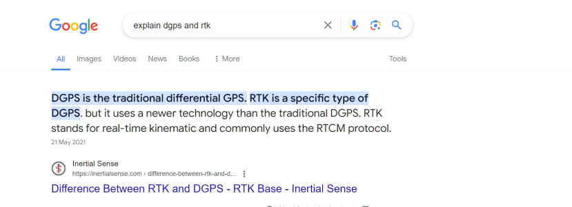
What's the difference between this and DGPS? Or is DGPS just this technology expanded to use a network of fixed base stations?
 

wonkywinch

Well-known member
Joined
30 Jul 2018
Messages
1,176
Location
Hamble, UK
Visit site
I used to work on Tacan which was first used in the 1950s..

The Russians have been jamming GPS.. I was watching" flight radar" last Friday, and aircraft were shown approaching the Ukraine, then suddenly a 767 would do warp speed and change position almost 90 degrees and several hundred miles in a few seconds.

Don't depend on your gps if you near an American carrier or fleet either, the yanks jam local GPS..
Some clever bods have now produced a live GPS spoofing website so you can see where trouble lies -

Live GPS Spoofing Tracker Map
 
Top